In February 2024, a pair of traveling birders staying above Kealakekua drove down from the highway, past the homes and the golf course, to the lava edge below. There was no beach, and the surf was breaking hard on the rocks. In one visit they counted seventeen bird species, and they wrote on their blog, Travels with a Fox, that it was the best look they had at an ʻio, the Hawaiian hawk.
They were guests on the island, and they reached the shoreline the same way anyone can. Behind the private gate at Hōkūlia is about 140 acres of shoreline park, and the public can walk it any day of the week. The way in is a parking pass and a drive down Halekiʻi Street. The trail runs past the walls of an old coastal settlement, follows some of the historic routes the State of Hawaiʻi took over in 2007, and ends on the shoulder of a volcanic vent called Puʻu Ohau. The park's public history runs back to a County agreement in 1998 and a settlement that took effect in March 2006.
The pass at Halekiʻi Street
Hawaiʻi County lists Hōkūlia first in its South Kona shoreline access guide. The listing gives hiking, fishing and picnicking as the uses, with parking, portable toilets and picnic tables at the Shoreline Park. Hours are 7 a.m. to 15 minutes after sunset. The County's directions are to drive down Halekiʻi Street, north of Central Kona Center, to the entrance gate, where park passes are handed out.
The Hawaii Beaches guide to the park fills in the rest. Halekiʻi Street heads inland from the Aliʻi Highway about 4.5 miles south of Keauhou. Ask at the entrance station for a Shoreline Park parking pass, then follow the "Shoreline Access" signs for about two miles to the lot, and leave the pass on the dashboard. The same guide calls the property private and open to the public, and it asks visitors to look after the park and its historical sites so it stays open to everyone.
Gate procedures can change, so ask the attendant at the entrance station whether anything is different before you drive on.
North from the lot, past the walls
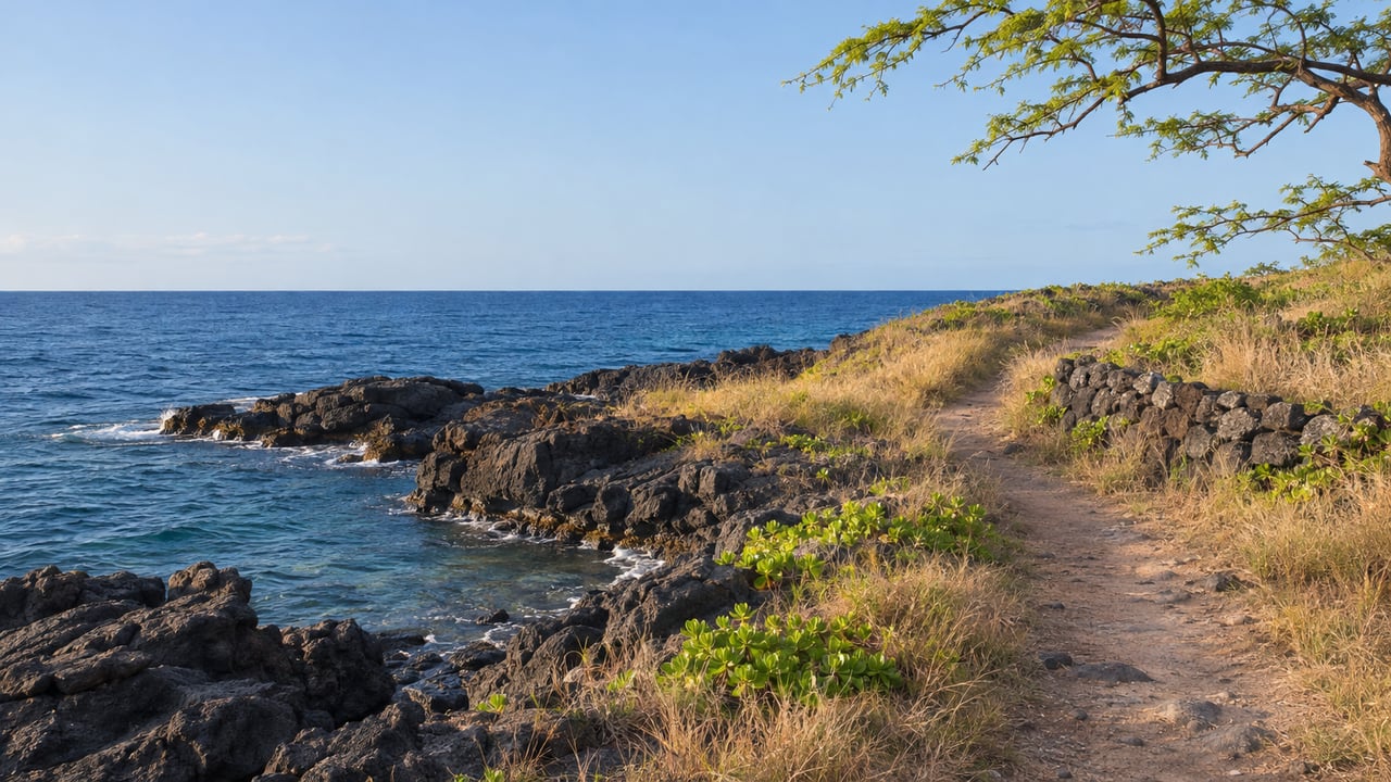
The trail starts on the north side of the parking lot. It follows the edge of the golf course and passes several rock walls that were part of a large former settlement, then reaches the water, where there are picnic tables and small pockets of sand behind the lava.
The state's planning records name that settlement. A December 2007 supplemental environmental notice for the project identifies the ancient Hokukano village below the development. The notice describes the park's archaeology as burials, heiau, habitation sites, walls and agricultural features, the remains of Hawaiian life on this coast. Hokukano is also the name of an ahupuaʻa. The project covers nine of them, listed in the notice as Honuaino, Hokukano, Kanaueue, Halekiʻi, Keʻekeʻe, ʻIlikahi, Kanakau, Kalukalu and Onouli. The road you turned onto at the highway carries the name of one of them, and the land divisions run from the uplands down to the shoreline you are walking.
The Hawaii Beaches guide also points out the tide pools along this uneven edge, and it warns visitors to keep back from the cliffs. The County describes the shoreline as rocky, with high cliffs, hazardous footing, currents and waves.
South, on old roads, toward Puʻu Ohau
The Hawaii Beaches guide considers the southern stretch the better walk. Facing the ocean, turn left and cross a short section of lava shoreline to the rough roads that double as a hiking trail. They narrow into a true trail that runs more than a mile and ends abruptly on the shoulder of Puʻu Ohau, a volcanic vent, just past a golf green. Old rock walls and other built structures line the way. The guide's instruction is to leave every rock pile exactly as you find it.
The record shows how much old travel this ground carries. A February 2019 board submittal from the Hawaiʻi Department of Land and Natural Resources names three historic routes in or next to the development: the Ala Loa, also called the Stepping Stone Trail; the Ala Nui, or Old Government Road; and the Old Cart Road. The document describes them as parallel routes that overlap in places, and it says the Old Cart Road runs mostly within the shoreline park. The State has owned two of the three since the Board of Land and Natural Resources accepted the deeds to the Stepping Stone Trail and the Old Cart Road on March 23, 2007 and added them to Nā Ala Hele, the state trail system.
Puʻu Ohau, at the end of the walk, matters for more than its geology. The 2007 notice records burials there. Treat the end of the path as the end of the walk and turn back there.
How a private community came to have a public shoreline
The park was planned before the first homes were built. The Hawaiʻi Supreme Court's 2006 opinion on the project describes how Oceanside proposed a large residential, recreational and agricultural development between Kailua-Kona and Kealakekua in the early 1990s. A County development agreement signed in April 1998 listed public benefits that included a five-mile highway and a 140-acre shoreline park.
Construction began in January 1999. After runoff events in 2000, a group of residents sued Oceanside and the state Department of Health on October 30, 2000. Protect Keopuka ʻOhana joined the case that November, when claims involving the County and Hawaiian burial sites were added. Ownership of the historic trails was also in dispute, and the State and Oceanside settled the trail questions in an agreement that took effect March 14, 2006.
The parties to that 2006 settlement included the developer, Hawaiʻi County, the Department of Land and Natural Resources, the Department of Health and Protect Keopuka ʻOhana. A year later the Stepping Stone Trail and the Old Cart Road went into the state trail system.
Who looks after it
The 2007 notice placed the 140-acre park and its preserved cultural sites in the care of a nonprofit, the Hōkūliʻa Park and Cultural Sites Association. It describes an advisory board drawn from descendants, cultural practitioners and the community, and two cultural-practice areas that together cover about 12 acres.
The association's work also reaches beyond this park. In a March 2025 opinion piece, Civil Beat quoted Mike Vitousek, president of the Hōkūliʻa Park and Cultural Sites Association, on the unmanaged Kaʻawaloa trail down to Kealakekua Bay. He called the trail "an unsafe environment," part of a broader push for managed access there. We covered where that effort stands in Why the Rules at Kealakekua Bay Stop at the Trailhead.
On the community side, Hōkūlia describes its Shoreline Historic Park as having hiking trails, a cultural interpretive center, viewing platforms, picnic areas and a canoe landing, with ocean activities at Nawawa Bay. We wrote about the outrigger outings from that landing in Why the Canoes Off Nawawa Bay Aren't Just for Show.
Before you go
Plan to arrive after the 7 a.m. opening and to be back at your car before the 15-minute window after sunset closes. A late-afternoon walk south toward Puʻu Ohau needs a turnaround time set before you start. Wear shoes that can handle broken lava. The County lists only portable toilets and picnic tables, so bring your own water. Leave every wall, platform and rock pile as you found it, since the County describes this as a culturally sensitive area and the guide's one rule is to disturb nothing. If you are interested in birds, bring binoculars for the ʻio.
The homes and homesites at Hōkūlia sit above this shoreline, on the slopes that run down to Hokukano and Nawawa Bay. If the walk to Puʻu Ohau has you wondering what the view looks like from higher up, the current homes and land are a good place to start.